Geoscientists reveal how Earth's forces are shaping the 'Roof of the World'
tags: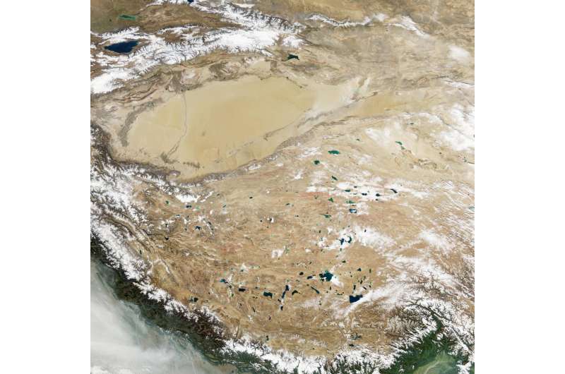
Geoscientists at the University of Glasgow have helped reveal new evidence about the formation of one of the highest mountainous areas on Earth—the Tibetan Plateau. A study by an international team of Chinese and U.K. geoscientists shows that the unique topography at the summit of the plateau is shaped by processes going on deep in Earth.
These features clearly indicate how far the Indian continental plate, to the south, has been pushed beneath the Asian plate, to the north, highlighting the connection between Earth's interior and its surface features.
Using geochronological analyses pioneered at the University of Glasgow and the Scottish Universities Environmental Research Center, the study team determined that the western and central parts of the Tibetan Plateau have distinct geological histories, reflected in their topography.
The findings, published in Nature Geoscience, reveal a distinct east-west difference in the plateau's exhumation history—the way rocks appear at the surface through plate movements and erosion. The research offers direct evidence linking differential exhumation across the plateau to the movement of the Indian plate beneath the Asian plate.
The Tibetan Plateau is the highest and largest upland area on Earth, with average elevations exceeding 4,500 m (14,800 feet). It acts as a major driver of the global climate and is the source of Asia's 10 largest rivers, providing water to billions of people.

Fieldwork traced east-west contrasts
Although the plateau appears to be a massive monolith, there are geological and topographical differences between the north and south and, crucially, from west to east that have never been investigated before.
With these questions in mind, researchers spent the summers of 2017–2019 conducting extensive geological surveys across Gerze in the central plateau and Rutog in the west, collecting a large suite of representative samples that were shipped to the University of Glasgow.
In a three-year collaborative research project, Ph.D. students from Nanjing University in China used low-temperature thermochronology techniques developed by researchers at the University of Glasgow and SUERC to determine the regional exhumation history and reconstruct past topography and relief.
Uplift diverged across the plateau
By combining the age data with geological information collected in the field and geophysical observations, the team discovered that uplift of the central and western parts of the plateau was radically different between 45 million and 20 million years ago.
This period coincides with a time when the Indian plate is known to have moved under the Asian plate in the west but had not yet reached the central plateau.
Prof. Cristina Persano, of the School of Geographical and Earth Sciences at the University of Glasgow, said, "The landscape, its topography and geological records are the only way we can investigate and understand what happens under our feet.
"This knowledge is of fundamental importance if we want to understand geological hazards, such as earthquakes and volcanoes, and, if, like Leonardo, we 'wonder' why nature looks like it does."
She added, "Being a geoscientist is fantastic. You get to see unique places, and as you admire nature and its complexity, you cannot help but wonder how unique our planet is; how everything, from plate tectonics happening kilometers under our feet to the formation of ozone kilometers above our heads, works in perfect harmony; and how delicate this equilibrium is. As a geoscientist, I feel the responsibility to understand and protect this equilibrium."
Evidence with wider implications
Fin Stuart, professor of isotope geosciences at SUERC, said, "This is the first convincing evidence that the subduction of the Indian plate beneath the Asian tectonic plate drove the formation of the Tibetan Plateau, and it explains the topographic differences between the eastern and western parts of Tibet.
"It has the potential to change our understanding of how mountain belts form, and it demonstrates the power of the new analytical techniques."
Publication details
Weiwei Xue et al, West versus Central Tibet exhumation difference influenced by Indian slab underthrusting, Nature Geoscience (2026). DOI: 10.1038/s41561-026-02043-9
Who's behind this story?

BSc Life Sciences & Ecology. Microbiology lab background with pharmaceutical news experience in oil, gas, and renewable industries. Full profile →

Master's in physics with research experience. Long-time science news enthusiast. Plays key role in Science X's editorial success. Full profile →
Citation: Geoscientists reveal how Earth's forces are shaping the 'Roof of the World' (2026, July 10) retrieved 11 July 2026 from https://phys.org/news/2026-07-geoscientists-reveal-earth-roof-world.html
This document is subject to copyright. Apart from any fair dealing for the purpose of private study or research, no part may be reproduced without the written permission. The content is provided for information purposes only.